
- About Rangpur Division
- Administration
- Local Government
-
Government Offices
Agriculture and Food
-
Department of Agriculture Extension
-
Department of Livestock, Rangpur Dvision
-
Department of Fisheries
-
regional Controller of Food
-
Additional Director Office,Department of Agricultural Extension,Dinajpur region
-
Deputy Director's Office, Department of Agricultural Marketing, Rangpur
-
Divisional Laboratory,Soil Resource Development Institute,Lalbag,Rangpur
-
Cotton Development Board, Regional Office, Rangpur
-
Superintending Engineer (Minor Irrigation) BADC, Rangpur Circle, Rangpur
Engineering and Communication
-
PWD
-
Divisional Office, RHD
-
Divisional Office, EED
-
Divisional Office, DPHE
-
Divisional Office, LGED
-
Divisional Office, PDB
-
Divisional Office, REB
-
Office of the Supervising Engineer, LGED, Rangpur Region, Rangpur
-
Bangladesh Water Development Board, Office of the Chief Engineer, Northern, Rangpur
-
Office of Superintending Engineer,BMDA,Rangpur Circle
-
Office of the Divisional Railway Manager
-
BRTA Rangpur Divisional Office
Other Offices
-
Divisional Office, ACC
-
Divisional Office, Election Commission
-
Regional Directorate Office, Rangpur
-
Divisional Office, Statistics
-
National Department of Consumer Protection
-
Forest Division
-
Divisional Office, Passport and VISA
-
Bangladesh Karmachari Kallyan Board
-
Rangpur Recreation Garden and Zoo,Rangpur
-
Meteorological Office
-
Regional Labour Office, Rangpur
-
BIDA, Divisional Office
-
Factories and Institutions Inspection Department, Deputy Inspector General\'s Office
-
Department of Agriculture Extension
- e-Services
- Information on Revenue (Appeal) Cases
- Revenue Administration
- District Brandbook
- Gallery
- Other Link
-
About Rangpur Division
Introduction to Rangpur Division
History and Traditions
Geography and Economy
-
Administration
Divisional Commissioner
Office of the Divisional Commissioner
Additional Commissioners/ Director (Local Government)
Officers and Staff
Field Officers
-
Local Government
City Corporation
Zila Parishad
-
Government Offices
Law and Order
Education and Culture
Agriculture and Food
- Department of Agriculture Extension
- Department of Livestock, Rangpur Dvision
- Department of Fisheries
- regional Controller of Food
- Additional Director Office,Department of Agricultural Extension,Dinajpur region
- Deputy Director's Office, Department of Agricultural Marketing, Rangpur
- Divisional Laboratory,Soil Resource Development Institute,Lalbag,Rangpur
- Cotton Development Board, Regional Office, Rangpur
- Superintending Engineer (Minor Irrigation) BADC, Rangpur Circle, Rangpur
Health
Land and Revenue
Engineering and Communication
- PWD
- Divisional Office, RHD
- Divisional Office, EED
- Divisional Office, DPHE
- Divisional Office, LGED
- Divisional Office, PDB
- Divisional Office, REB
- Office of the Supervising Engineer, LGED, Rangpur Region, Rangpur
- Bangladesh Water Development Board, Office of the Chief Engineer, Northern, Rangpur
- Office of Superintending Engineer,BMDA,Rangpur Circle
- Office of the Divisional Railway Manager
- BRTA Rangpur Divisional Office
ICT
Human Resource Development
Other Offices
- Divisional Office, ACC
- Divisional Office, Election Commission
- Regional Directorate Office, Rangpur
- Divisional Office, Statistics
- National Department of Consumer Protection
- Forest Division
- Divisional Office, Passport and VISA
- Bangladesh Karmachari Kallyan Board
- Rangpur Recreation Garden and Zoo,Rangpur
- Meteorological Office
- Regional Labour Office, Rangpur
- BIDA, Divisional Office
- Factories and Institutions Inspection Department, Deputy Inspector General\'s Office
-
e-Services
National e-Services
- Information on Revenue (Appeal) Cases
-
Revenue Administration
রংপুর বিভাগের সায়রাত এর তথ্য
অর্পিত সম্পত্তি সংক্রান্ত
পরিত্যক্ত সম্পত্তি সংক্রান্ত
-
District Brandbook
জেলা ব্র্যান্ডবুক
- Gallery
- Other Link
Tradition of Rangpur
Rangpur Division is a historically rich region located in the northern part of Bangladesh. Since ancient times, this area has held a glorious and diverse history. Rivers such as the Jamuna, Teesta, Brahmaputra, Ghaghot, Dharla, Karatoa, and Punarbhaba flow through this region. According to Hindu scriptures, the eastern part of India was once known as Kamrup or Pragjyotishpur, which included the present-day Rangpur or "Rongpur." During the reign of King Bhagadatta (around 1500 BCE), Rangpur was a part of Pragjyotishpur. Later, during the time of Emperor Samudragupta (340 CE), Kamrup became a tributary state. Eventually, this region came under the administration of the Cooch Behar kingdom. From the mid-4th century, the region was ruled by the Burma royal dynasty, followed by the Pala, Sena, and other dynasties.
In 1765, after the East India Company obtained the rights to collect revenue (Diwani), Rangpur came under British administration. The first peasant rebellion in this region occurred in the same year. During the Sepoy Rebellion of 1857, the insurgents instilled fear among the British rulers in this area. In 1930, the Civil Disobedience Movement initiated by the Congress began in different parts of Rangpur. In October 1946, a meeting of northern Bengal's peasant leaders was held here, and in November, the Tebhaga Movement commenced.
Origin of the Name
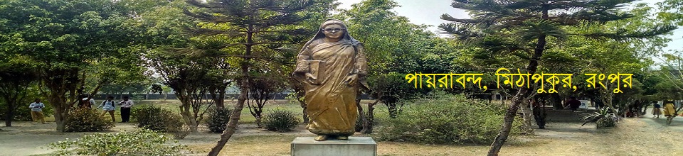
The exact origin of the name "Rangpur" is still uncertain. Some believe that during the Mahabharata era, King Bhagadatta of Pragjyotishpur had a palace of colors (Rang Mahal) in this region, giving rise to the name "Rangpur." Others claim that the name of Payraband, the birthplace of Begum Rokeya—pioneer of women’s awakening—originated from King Bhagadatta’s daughter, Payrabati. Some historians suggest Rangpur was once home to a dyeing factory where jute fabric (gunny bags) was colored, thus the name Rangrezpur, which eventually became Rangpur. However, many historians attribute the naming to Ikhtiyar Uddin Muhammad bin Bakhtiyar Khilji, as “Rangpur” is a Persian word, likely established during his rule.
Geographical Location
Rangpur Division is a geographically and historically significant region in the north of Bangladesh. It lies between 25°50' North latitude and 89°00' East longitude. The Teesta River marks the northern and northeastern boundaries, separating the division from Lalmonirhat and Kurigram districts. The total area of the division is 16,320.26 square kilometers. It comprises 8 districts, 58 upazilas (sub-districts), 527 unions, 27 municipalities, and 12,549 mouzas (revenue villages).
Literature and Culture
Rangpur’s history, heritage, literature, language, and culture are ancient and enriched. With its diverse nature and scenic beauty, Rangpur is a cradle of aesthetics and vibrant life—indeed, a land "full of colors and joy." This vibrancy encompasses education, literature, music, culture, and especially folk traditions. Historically, Rangpur is part of the ancient Barind region of Bangladesh, later known as the Gaur region.
Ancient Monuments and Places of Interest
-
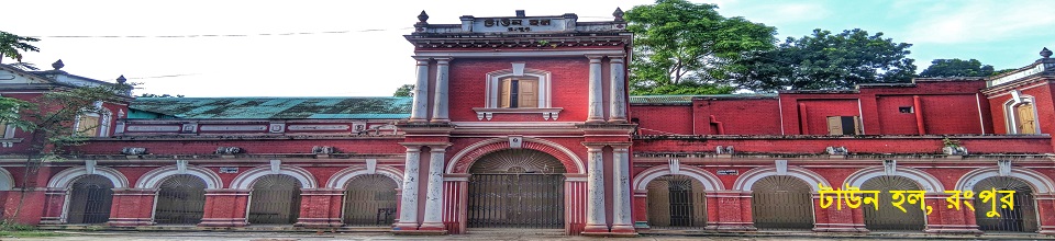
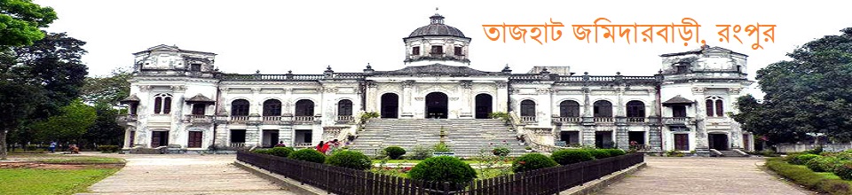
Carmichael College, Begum Rokeya’s house in Payraband, Monthona Zamindar house, Keramatia Mosque, Rangpur Museum, Shrine of Maulana Keramat Ali Jainpuri (R), Shrine of Hazrat Shahjalal Bokhari, Tajhat Zamindar Palace, Qutub Shah’s Shrine, Raypur Zamindar House, Ruins of Raja Nilambar’s residence in Patgram, Chandonhat Hari Mandir, Dimla Raj Kali Temple, and Mithapukur Tank, believed to be excavated during the Mughal era.
Ancient Monuments and Heritage by District:
1. Rangpur District:
-
Tajhat Zamindar House, Tepar Zamindar House, District Council Building, Rangpur Zoo, Carmichael College, Vinnya Jagat, Bakhtiar Mosque, Borobil Mosque, Chandipur Mosque, Fulchouki Mosque, Mithapukur Mosque, Keramatia Mosque, Laldighi Mosque, Mohipur Mosque, Bhangni Mosque, Dimla Kali Temple, Tribigraha Temple, Ajit Roy’s Zamindar House, Itakumari Zamindar House, Deyaan Bari Zamindar House (Fani Bhushan Majumder), Pirgacha Zamindar House, Payraband Zamindar House, Rajbari, and Chandipur Mosque.
2. Nilphamari District:
-
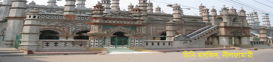
Angra Mosque, Nil Sagar, District School, Chini Mosque, Saidpur Railway Workshop, Teesta Barrage, Haji Talenga Mosque, Saidpur Catholic Church.
3. Dinajpur District:
-
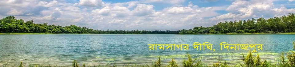
Swapnapuri, various rooms of Sitakot Vihar, Ancient Fort Mosque in Ghoraghat, Nayabad Mosque, Sura Mosque, Kantanagar Temple, Lion Gate of Dinajpur Zamindar House, Mass Grave in Parbatipur, Parbatipur Railway Station, Barapukuria Coal Mining Complex, Dinajpur Museum, Ramsagar, Ramkrishna Mission.
4. Panchagarh District:
-
Tea Gardens, Bhitargarh, Mirzapur Shahi Mosque, Haren Saha Shiva Temple, Historic Kajol Dighi, Rocks Museum.
5. Thakurgaon District:
-
Jamalpur Zamindar House Mosque, Pirganj Shiva Temple, Raja Thak Nath’s Palace.
6. Gaibandha District:
-
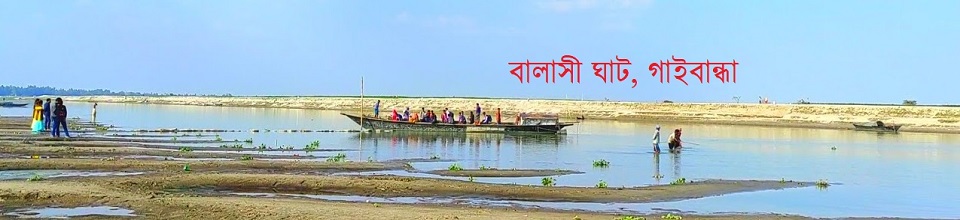
Masta Mosque, Parakachua Mosque, Bardhan Kuthi Zamindar House, Rangpur Sugar Mill.
7. Kurigram District:
-
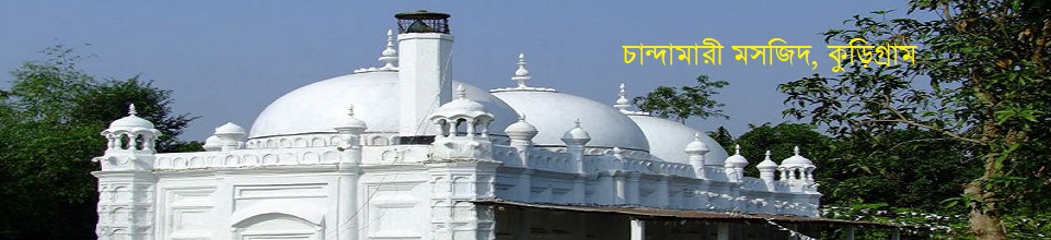
Chandamari Mosque, Dolmanj Temple, Panga Zamindar House, Chilmari Port, Munshi Bari.
8. Lalmonirhat District:
-
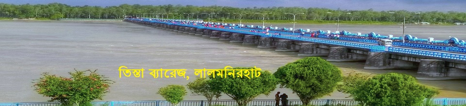
Nidaria Mosque, Kali Temple of Tushbandar Zamindar House, Kakina Zamindar House, Sukan Dighi, World War II Memorial Airfield, Teesta Bridge, Tin Bigha Corridor, Burimari Land Port.
|
|
|


Thanking you - ICT Cell, Divisional Commissioner's Office, Rangpur Division, Rangpur
Planning and Implementation: Cabinet Division, A2I, BCC, DoICT and BASIS
Technical Assistance:
![]()
Developed By:
